Test News
Friday, April 30th, 2010Check out our news!

Check out our news!
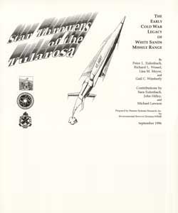 Star Throwers of the Tularosa: The Early Cold War Legacy of White Sands Missile Range
 Archaeologists’ Pocket Companion
This handy, pocket-sized guide is a compendium of mathematical, statistical, and cartographic tables, formulae, conversion factors, and symbols commonly consulted during archeological survey. It has a laminated cover to stand up to heavy use.
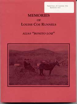 Memories of Louise Coe Runnels Alias “Bonita Lou”
Louise Coe Runnels was born on August 5, 1915, at home in Eagle Creek, Lincoln County, New Mexico. These memoirs and stories are recollections of her life up until the year 1994. The original manuscript was published by Texas Tech University in Lubbock. When Louise attended an autograph party at HSR’s Tularosa lab housed in the old Tularosa Women’s Club, HSR had just finished Homes on the Range, a book about the pioneer ranching families in the San Andres Mountains. Louise asked if HSR would help her publish a second edition of her book.
 Fourth Jornada Mogollon Conference (Oct. 1985) Collected Papers
The 1985 Jornada Mogollon Conference was held in Tularosa, New Mexico, in October 1985. Sponsored by Human Systems Research, the conference served as a forum for a symposium on southeastern New Mexico. Those papers were edited by Susana R. and Paul Katz and were published by the Bureau of Reclamation, Pecos River Projects Office, Carlsbad, under the title Advances in Middle Pecos Archaeology; Proceedings of a Symposium Held at the Fourth Jornada Conference. The remainder of the presented papers cover a broad variety of topics pertaining to the prehistory of south-central New Mexico.
Papers included in this volume are:
• Carmichael, David: Obsidian Hydration Analysis of Pueblo Period Sites in the Southern Tularosa Basin
• Foster, Michael S.: An Isolated Structure from Keystone Dam: Site 33 South
• Hunter, Rosemary: The Tony Colon Site I
• Johnson, Michael and Steadman Upham: Approaches to Adaptive Diversity: A Preliminary Report on Archaeological Investigations in the Organ Mountains, Southern New Mexico
• Laumbach, Karl W. and David T. Kirkpatrick: A Cultural Resource Inventory of the Southern Edge of the Chupadera Mesa: The Sgt.York Archaeological Project
• Lekson, Stephen H.: Regional Systematics in the Later Prehistory of Southern New Mexico
• Newton, Richard E. and Steadman Upham: Projectile Points as Chronological Marker: A Reassessment of Morphological Attributes as Time-Sensitive Indicators
• Ravesloot, John C.: The Santa Teresa Project: Temporary Use Sites of the Mesilla Bolson, Southern New Mexico
•Seaman, Timothy J. and Barbara J. Mills: What Are We Measuring? Rim Thickness Indices and Their Implications for Changes in Vessel Use
•Tainter, Joseph A.: The Mountainair Lithic Scatters Revisited: A Consideration of Research Design in Archaeological Experimentation
• Wiseman, Regge N.: The Continuing Saga of the King Ranch Site (LA 26764): Update and Summary of Findings
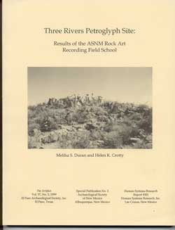 Three Rivers Petroglyph Site: Results of the Rock Art Recording Field School
The Rock Art Recording Field School of the Archaeological Society of New Mexico worked at the Three Rivers Petroglyph Site in Otero County from 1987 through 1992. The Three Rivers Petroglyph Site contains over 21,000 rock-art designs that are mostly contemporaneous with the Jornada Mogollon (A.D. 400-1450) culture of south-central New Mexico. This six year effort has provided 100 percent documentation of the elements within the 0.22 square mile site on Bureau of Land Management and State of New Mexico land.
The report summarizes the numerous elements, identifies research themes, and provides perspectives on the significance of the Three River Petroglyph Site. It is discussed in relation to the natural environment, the archaeological context, and the rock-art context. Information from the site and other studies of rock-art sites in the American Southwest and Mexico suggest potential research questions for studying Jornada Mogollon rock art and culture.
Three Rivers Petroglyph Site: Results of the Rock Art Recording Field School
By Meliha S. Duran and Helen K. Crotty ©1994 134 pages $12.00
The Rock Art Recording Field School of the Archaeological Society of New Mexico worked at the Three Rivers Petroglyph Site in Otero County from 1987 through 1992. The Three Rivers Petroglyph Site contains over 21,000 rock-art designs that are mostly contemporaneous with the Jornada Mogollon (A.D. 400-1450) culture of south-central New Mexico. This six year effort has provided 100 percent documentation of the elements within the 0.22 square mile site on Bureau of Land Management and State of New Mexico land.
The report summarizes the numerous elements, identifies research themes, and provides perspectives on the significance of the Three River Petroglyph Site. It is discussed in relation to the natural environment, the archaeological context, and the rock-art context. Information from the site and other studies of rock-art sites in the American Southwest and Mexico suggest potential research questions for studying Jornada Mogollon rock art and culture.
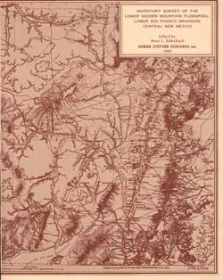 Inventory Survey of the Lower Hidden Mountain Floodpool, Lower Rio Puerco Drainage, Central NM
HSR conducted an intensive inventory archaeological survey of cultural resources, within 10,360 acres or approximately 16.2 square miles, potentially affected by construction of the Lower Hidden Mountain Dam, Socorro and Valencia Counties, New Mexico. The status of lands includes patented, private lands, New Mexico State Trust lands, and public domain. The U.S. Army Corps of Engineers initiated this survey to identify cultural resources potentially affected by the proposed action; assess the significance and potential eligibility to the National Register of Historic Places for each resource in the inventory; evaluate potential adverse impact on historic and prehistoric sites; identify possible mitigation strategies; and develop an overall research perspective for cultural resources within the lower Rio Puerco drainage
In addition, the survey evaluates predications concerning density and character of archaeological resources based upon a 10% stratified random sample reconnaissance of the region. Data on site types, periods of occupation, location, frequency and density of artifacts, environmental context, and basic analysis of assemblages are presented. Particular attention is devoted to formal field methods of the survey, analysis of ceramic and lithic assemblages, geological and sedimentary history of the drainage, evaluation of a 10% sample reconnaissance, and formal methods for evaluating potential resource significance.
One hundred sixty (160) sites are reported in detail, spanning the Archaic through Historic periods (circa 1000 B.C. to A.D. 1900). Most of these are lithic, or lithic and ceramic, scatters, representing small campos and activity areas deposited during intermittent occupations, possibly during periods of climatic or environmental stress. Evidence of architectural features in the inventory area is limited to five small historic sites.
Inventory Survey of the Lower Hidden Mountain Floodpool, Lower Rio Puerco Drainage, Central NM
Edited by Peter L. Eidenbach With Contributions by Peter L. Eidenbach, Richard C. Chapman, A.H. Warren, Cye Gossett, Bill Gossett, D.W. Love, J.W. Hawley, and J.D. Young ©1982 590 pages $25.00
HSR conducted an intensive inventory archaeological survey of cultural resources, within 10,360 acres or approximately 16.2 square miles, potentially affected by construction of the Lower Hidden Mountain Dam, Socorro and Valencia Counties, New Mexico. The status of lands includes patented, private lands, New Mexico State Trust lands, and public domain. The U.S. Army Corps of Engineers initiated this survey to identify cultural resources potentially affected by the proposed action; assess the significance and potential eligibility to the National Register of Historic Places for each resource in the inventory; evaluate potential adverse impact on historic and prehistoric sites; identify possible mitigation strategies; and develop an overall research perspective for cultural resources within the lower Rio Puerco drainage
In addition, the survey evaluates predications concerning density and character of archaeological resources based upon a 10% stratified random sample reconnaissance of the region. Data on site types, periods of occupation, location, frequency and density of artifacts, environmental context, and basic analysis of assemblages are presented. Particular attention is devoted to formal field methods of the survey, analysis of ceramic and lithic assemblages, geological and sedimentary history of the drainage, evaluation of a 10% sample reconnaissance, and formal methods for evaluating potential resource significance.
One hundred sixty (160) sites are reported in detail, spanning the Archaic through Historic periods (circa 1000 B.C. to A.D. 1900). Most of these are lithic, or lithic and ceramic, scatters, representing small campos and activity areas deposited during intermittent occupations, possibly during periods of climatic or environmental stress. Evidence of architectural features in the inventory area is limited to five small historic sites.
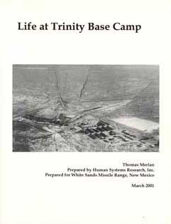 Life at Trinity Base Camp
A very remote and isolated location in central New Mexico was selected for the Trinity Test site. The soldiers assigned to the Trinity Test site did not know their final destination when they received their travelorders to New Mexico. With a few rare exceptions, the soldiers and other personnel who set up the experiment did not know the purpose of their work until the actual explosion took place. To maintain this high level of secrecy, a base camp, the headquarters of the McDonald Brothers Ranch, was established a few miles southwest of Ground Zero. While the soldiers and scientists developed the necessary infrastructure for the test, Trinity Base Camp was their home. Because of the high level of security, the soldiers never left Base Camp during the seven months prior to the Trinity event. Baseball, poker, and playing polo on horses from the military police detachment helped alleviate the boredom.
Life at Trinity Base Camp provides a vivid description of everyday life at this camp through photographs and interviews with individuals like the camp clerk, a military policeman, and the young private responsible for the garbage detail. Unlike the abundant scientific reports available for Trinity Experiments, the written record is nonexistent for learning about the day-to-day activities at Trinity Base Camp.
Mr. Merlan relied heavily on interviews with several individuals, often using the words of these men to describe the details about the camp and daily life. Historic photographs of the Trinity Base Camp, the soldiers, and other participants contribute to the description of camp life. In addition, the archaeological and architectural remains of Trinity Base Camp were documented and verified during the interviews and site visits.
Life at Trinity Base Camp
by Thomas Merlan ©2001 142 pages $15.00
A very remote and isolated location in central New Mexico was selected for the Trinity Test site. The soldiers assigned to the Trinity Test site did not know their final destination when they received their travelorders to New Mexico. With a few rare exceptions, the soldiers and other personnel who set up the experiment did not know the purpose of their work until the actual explosion took place. To maintain this high level of secrecy, a base camp, the headquarters of the McDonald Brothers Ranch, was established a few miles southwest of Ground Zero. While the soldiers and scientists developed the necessary infrastructure for the test, Trinity Base Camp was their home. Because of the high level of security, the soldiers never left Base Camp during the seven months prior to the Trinity event. Baseball, poker, and playing polo on horses from the military police detachment helped alleviate the boredom.
Life at Trinity Base Camp provides a vivid description of everyday life at this camp through photographs and interviews with individuals like the camp clerk, a military policeman, and the young private responsible for the garbage detail. Unlike the abundant scientific reports available for Trinity Experiments, the written record is nonexistent for learning about the day-to-day activities at Trinity Base Camp.
Mr. Merlan relied heavily on interviews with several individuals, often using the words of these men to describe the details about the camp and daily life. Historic photographs of the Trinity Base Camp, the soldiers, and other participants contribute to the description of camp life. In addition, the archaeological and architectural remains of Trinity Base Camp were documented and verified during the interviews and site visits.
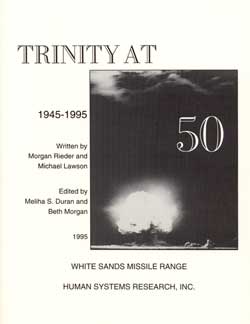 Trinity at 50
On July 16, 1945, the world entered the Nuclear Age with the successful detonation of the first atomic bomb at Trinity Site in New Mexico. The nuclear test represented the culmination of an unprecedented collaboration between scientists and the military, forged by the nation’s defense needs arising from World War II. Yet that event had a very humble beginning in an undeveloped, virtually abandoned, isolated ranching area in the Chihuahuan Desert, miles from the nearest town.
Trinity at 50 tells of the archaeological resources at Trinity Site on White Sands Missile Range – what came before the blast and what was required to test the most awesome device of the twentieth century. The locus of the test is now designated Trinity Site National Historic Landmark (LA 100,000). The site possesses several types of cultural resources – the facilities for the Trinity Test, the remains of five historic ranches operating in the area when it was evacuated for military purposes in 1942, and almost 50 prehistoric sites consisting of artifact scatters and hearths dating to Paleoindian, Archaic, and Mogollon occupation of the vicinity. In addition to describing the prehistoric and historic sites, Trinity at 50 addresses the preservation of these resources, several of which are on or potentially eligible for the National Register of Historic Places.
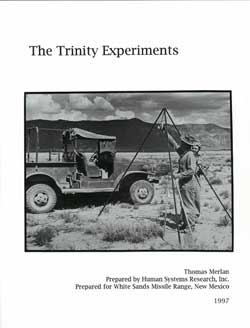 The Trinity Experiments
On July 16, 1945, at 5:29:45 a.m. Mountain War Time, the wold entered the Nuclear Age with the successful detonation of the first atomic bomb at Trinity Site in New Mexico. The Trinity Experiments is the first study of the actual experiments associated with evaluating the effects of the explosion. The study was very timely because, during the final year of this study, several scientists associated with the Manhattan Project and nuclear physics passed away.
The Trinity Experiments describes some elements of the experimental program that accompanied the atomic test, with emphasis on experiments deployed in the core area of the test. The information should facilitate the identification of artifacts that may have remained in place after the test. Using oral interviews of scientists and their post-blast technical reports, plus historic photographs, Mr. Merlan has documented how the scientists adapted and modified their experiments from the original plans developed at Los Alamos and how they made do with the technology at hand, with no idea of the final magnitude of the explosion. The Trinity Experiments is written for the general audience. Through the clearly written and nontechnical descriptions and illustrations of the experiments, the reader gains an understanding of how the first atomic explosion was recorded.
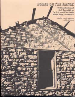 Homes on the Range: Oral Recollections of Early Ranch Life on the U.S. Army WSMR, New Mexico
Homes on the Range is a set of recollections, stories, and photographs from ranching families who homesteaded New Mexico’s last frontier – the barren deserts and rugged mountains of the Tularosa Basin and the Jornada del Muerto – during the late nineteenth and early twentieth centuries. White Sands Missile Range is engaged in the recording of the rural homesteads, isolated windmills, Angora goat sheds, and other physical remains of the homesteading era that dot their landscape. Recording the architecture and archaeology helped preserve history but did little to illuminate it. To meet the need for additional information, the Department of Defense Legacy Resource Management Program provided funding for an oral-history project in which members of the families who homesteaded land that now lies on White Sands Missile Range were interviewed about their ranching experiences.
In Homes on the Range, the oral-history interview responses are presented in a continuing narrative format. The reader may learn about where these families came from and how they ended up in the Tularosa Basin and the Jornada del Muerto; how the ranchers faced blizzards, drought, floods, and other natural forces; what the cattle, goats, and sheep survived on in good years and bad; how to care for calves, lambs, and goat kids and what roundup and branding time was like; how to doctor people and animals with home remedies and what nature provides; what it was like to build a house and raise a family so far from civilization; what it was like to be a child on a ranch; and what these folks did for rest and relaxation. A companion volume, School Days, focuses on how the families secured an education for their children.
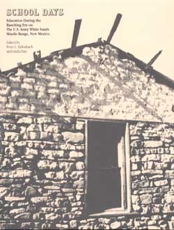 School Days: Education During the Ranching Era on the U.S. Army White Sands Missile Range, New Mexico
edited by Peter L Eidenbach and Linda Hart ©1997 87 pages $15.00
School Days is a set of recollections, stories, and photographs from ranching families who homesteaded New Mexico’s last frontier – the barren deserts and rugged mountains of the Tularosa Basin and the Jornada del Muerto – during the late nineteenth and early twentieth centuries. White Sands Missile Range is engaged in the recording of the rural homesteads, isolated windmills, Angora goat sheds, and other physical remains of the homesteading era that dot their landscape. Recording the architecture and archaeology helped preserve history but did little to illuminate it. To meet the need for additional information, the Department of Defense Legacy Resource Management Program provided funding for an oral-history project in which members of the families who homesteaded land that now lies on White Sands Missile Range were interviewed about their ranching experiences.
These rural families built wood-frame and adobe houses, dug water wells, and constructed corrals and earthen ponds or stock tanks to catch and hold the precious rainfall. As these families grew, the need for schools increased. A good education was prized by these new settlers. Several educational patterns developed in the rural New Mexico mountains. Some families pooled their efforts and built one-room schoolhouses. Others maintained a second home in town where their children lived during the school year. A few families sent their children to boarding schools. Occasionally young children received their early education through home schooling. School Days reports on the experiences of ranch children in these various settings. They speak of the teachers, the antics, the conditions, and piling into cars or trucks that served as buses and bouncing for hours along rocky, rutted, and washed out roads to get to school. Or they drift back to the homesickness that overcame them in the cold atmosphere of boarding school. And they look back with appreciation on their parents’ determination that they receive a good education. A companion volume, Homes on the Range, presents the more complete stories of these people’s lives in this rugged setting.
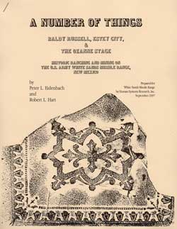 A Number of Things: Baldy Russell, Estey City, and the Ozanne Stage: Historic Ranching and Mining on the U.S. Army White Sands Missile Range, New Mexico
A Number of Things results from continuing studies by Human Systems Research, Inc., on the late nineteenth century history of the northern Jornada del Muerto, Tularosa Basin, and Oscura Mountains of White Sands Missile Range, New Mexico.
This forbidding landscape was virtually uninhabited in the early 1890s when Bill Mitchell, alias Henry “Baldy” Russell, developed a series of hand-dug wells, establishing the first ranching homesteads in the area. At about the same time, miners began to explore the area, mail and stagecoach service connected the Rio Grande with the isolated settlements of the Sacramento and Sierra Blanca Mountains, and the brief cattle boom of the 1880s retreated to the grassy plains along the Rio Grande.
A Number of Things uses archaeological data and historic documents to tie together seemingly unrelated Baldy Russell, Estey City, and the Ozanne Stage. They are, simply, a number of decidedly interesting things from the past on today’s White Sands Missile Range. Outlaw Baldy Russell wandered throughout this wilderness, providing the central theme, threading the contextual fabric of this little-known period. This theme weaves together West Texas, the source of many early ranch families; the first homesteads, several of which became the site for the Trinity atomic test in 1945; speculative mining ventures such as Estey City, which brought the railroad, ending the nineteenth and christening the twentieth century and displacing earlier, more romantic, frontier technologies like the Ozanne Stage.
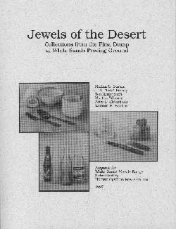 Jewels of the Desert: Collections from the First Dump at White Sands Proving Ground
Jewels of the Desert is one of the first studies of material culture of a Cold War military installation. In 1994, during the construction of a new commissary building at White Sands Missile Range, a previously unknown dump was encountered. The artifacts from this dump, possibly the earliest on White Sands Proving Ground (now known as White Sands Missile Range), provide us with insight into the daily lives of the soldiers and scientists working on the V-2 missile program. Many of the artifacts relate to the personal lives of these men, stationed in temporary quarters in the desert of southern New Mexico. Dates on various bottles indicate the dump was in use from July 1945 to 1947.
Jewels of the Desert provides the reader with a brief history of White Sands Proving Ground, a photographic and descriptive inventory of diagnostic artifacts, and an interpretation of daily life of personnel at the post. A companion volume, From Barren Desert to Thriving Community: A Social History of White Sands Missile Range, 1945- 1954 (William B. Boehm 1997), documents the development of White Sands Proving Ground as a community in addition to a test facility for missiles.
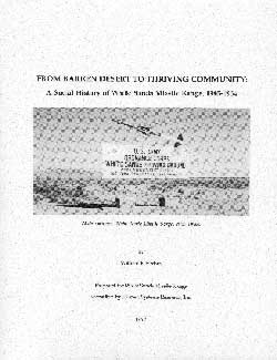 From Barren Desert to Thriving Community: A Social History of White Sands Missile Range, 1945-1954
In late August 1994, a buried historic dump was discovered during the construction of a new commissary building on White Sands Missile Range. Artifacts exposed in the back dirt piles and trench walls helped date the dump to the mid-1940s. The artifacts provided limited information about the people who lived and worked at White Sands Proving Ground, now known as White Sands Missile Range. The discovery of the dump prompted this study of the early years of White Sands Proving Ground. Written for the general audience, the history is based on historic photographs, newspaper accounts, administrative records, oral-history interviews, and the artifacts from the dump.
White Sands Proving Ground began as an isolated temporary test site near the end of World War II and has evolved into a permanent community. This development was influenced by a wide range of factors, from devastating 100-mile-per-hour winds to the international threats generated by Cold War politics. Today, White Sands Missile Range continues to serve as a test facility in the post-Cold War world. From Barren Desert to Thriving Community describes how this community of scientists, civilian personnel, and soldiers lived when not involved with scientific tests. Many White Sands Missile Range institutions and the community activities and functions associated with them began in the late 1940s and early 1950s and are still active today. A companion volume, Jewels of the Desert: Collections from the First Dump at White Sands Proving Ground, describes the artifacts recovered from the dump and provides insight into the daily lives of the soldiers and scientists working at the proving ground.
 Capture the Past: A Manual for Interdisciplinary Studies in New Mexico’s Cultural Heritage
As we try to “capture the past” for our students, we suddenly realize that the past, both historic and prehistoric, has the power to deeply move us in profound ways. When this happens, it is often because a teacher or some other special individual has shown us, or imprinted upon our hearts, a sense of excitement and awe.
Creativity and imagination can blossom in your classroom as you develop exciting lesson plans that will generate respect and interest in your students. Archaeology is a magic word; it encompasses many areas of study, from scientific theory, research, and interpretation, to art, social studies, language arts, math, personal relationships, and cooperative, hands-on learning.
Archaeological work is a deliberate, painstaking process. Wheelbarrows or buckets are filled with dirt; the dirt is filtered through wire mesh to catch small objects; pot sherds, pipe stems, arrow heads, an awl, sinew, bone, bullets, fragments of cloth or leather, and other miscellaneous items are revealed. And here archaeology begins to take on an excitement. Daily life may be captured in the mesh and become significant, as these items are viewed in context with one another. Some items fill in the blanks of a complicated mystery, others add a splash of color to a seemingly lifeless scene from the past, and still others generate further questions in a puzzle yet unsolved.
Isn’t it much more practical, as well as more fun, to show how math and science can be applied to an archaeological excavation, than to drag out those tired, seemingly irrelevant word problems we are offered to introduce or review the basic concepts of measurement, distance, spatial relationships, graphing, circumference, diameter, or climatic conditions? Providing students with real-life applications for the exercises they complete in class allows them the realization that what they study in school really can have something to do with their future.
New Mexico’s heritage is incredibly diverse, challenging, and colorful. This manual contains for you, the heritage educator, innumerable ideas and sources for investigating archaeology. Each unit is comprised of one or more lesson plans incorporating hands-on activities, readings, and exercises using materials that can be easily created, duplicated, or obtained. The lessons are open-ended to encourage instructors to add or delete materials as their own imaginations, school budgets, and class-time dictate.